Subscribe here for our new FREE Live Love Las Cruces newsletter to stay up to date with upcoming events and happenings in Las Cruces.
Delivered on Monday, Wednesday and Friday with an occasional special edition. We never Spam. Unsubscribe anytime.
Discover Las Cruces

Business Spotlight – Custom Pergolas by Wood You Too
Wood You Too!? LLC Custom Western Red Cedar Pergolas, Privacy Fences, Decks & Patios. Crafting Shade and Memories in Las…Read more

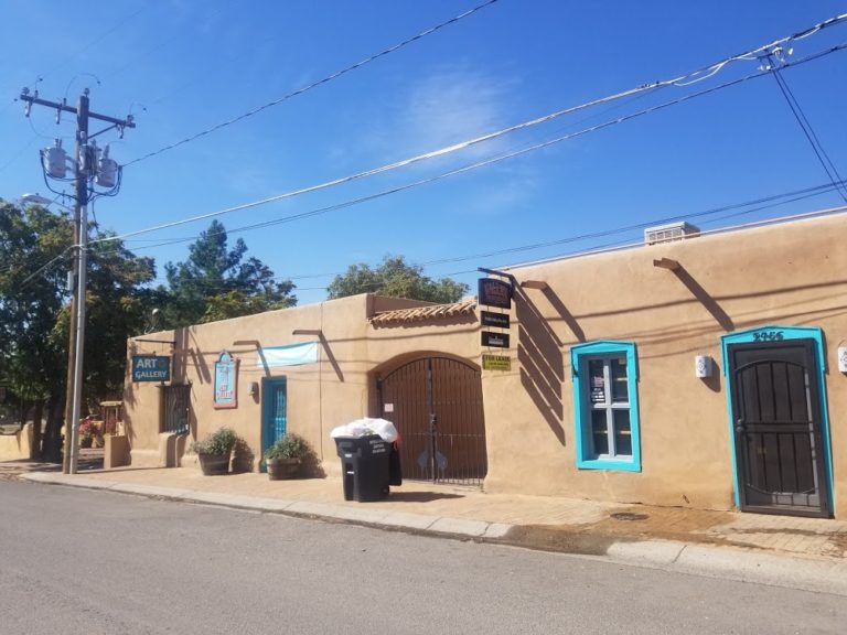
Things to See and Do in Las Cruces NM
Las Cruces, New Mexico, is a charming city located in the southern part of the state. With a rich history,…Read more

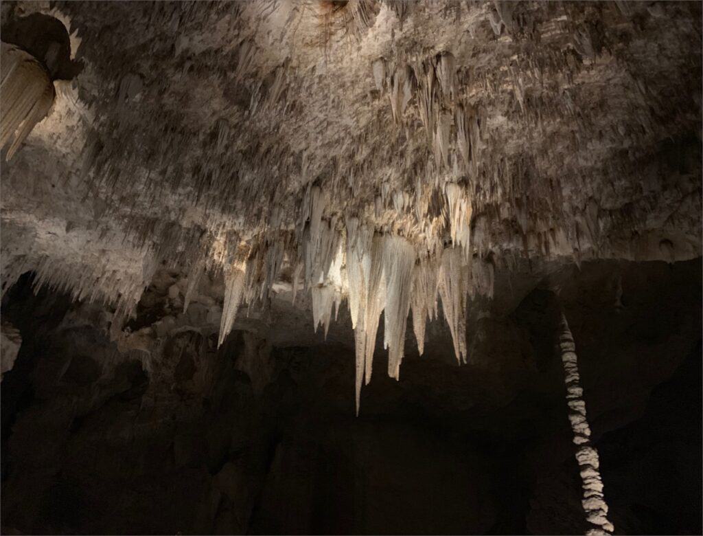
Exploring Carlsbad Caverns State Park: A Guide to Must-See Attractions and Activities
Carlsbad Caverns State Park is a must-visit destination for anyone traveling to New Mexico. The park is a natural wonder,…Read more


Las Cruces Directory
Come and Explore Las Cruces
Las Cruces, the second largest city in New Mexico, is a very friendly city that is often ranked as one of the best places to live, work, play and retire by many major publications. Come and enjoy over 300 days of sunshine!
Popular Local Restaurants


Featured Businesses


Find more local businesses here: Business Search
Local Attractions


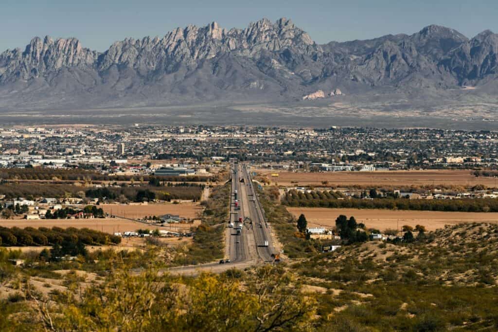


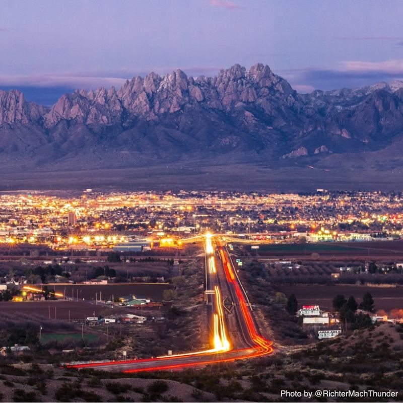
Where is Las Cruces Located?
Las Cruces, New Mexico is located in the southern part of the state at the crossroads of Interstate 10 and Interstate 25. It lies 225 miles south of Albuquerque and 42 miles northwest of El Paso, Texas. Las Cruces is the county seat and largest city of Doña Ana County. The city is situated in the Mesilla Valley on the flood plain of the Rio Grande River. Get Las Cruces Directions.
What is the Elevation of Las Cruces?
The elevation of Las Cruces, New Mexico is approximately 3,800 feet or 1,160 meters above sea level.
Some key details:
-
Las Cruces is the second largest city in New Mexico, located in the southern part of the state near the Mexican border.
-
It sits in the Mesilla Valley at the base of the Organ Mountains, which rise up to nearly 9,000 feet to the west.
-
The city’s elevation gives it a warm, arid climate. Average annual high temperatures are in the 70s F and lows in the 40s F.
-
Higher elevations in the surrounding mountains provide opportunities for hiking, camping, and other outdoor recreation amidst scenic desert landscapes.
-
At around 3,800 feet, Las Cruces is over a mile higher than many other cities in the region but still lower than mountains to the east and west, contributing to its transition zone climate between low desert and highlands.
Is Las Cruces considered High Elevation?
No, Las Cruces, New Mexico would not generally be considered a high altitude location. While elevation does play a role in its climate and environment. Altitudes above 5,000-8,000 feet are usually considered high altitude depending on the context. Some definitions use 3,000-8,000 feet as a moderate altitude range.
So in summary, the approximate elevation of Las Cruces, New Mexico places it at 3,800 feet or 1,160 meters above sea level, situated at the base of the Organ Mountains in the southern part of the state.
-
Is Las Cruces a good place to retire?
No, Las Cruces, New Mexico would not generally be considered a high altitude location. While elevation does play a role in its climate and environment:
-
Altitudes above 5,000-8,000 feet are usually considered high altitude depending on the context. Some definitions use 3,000-8,000 feet as a moderate altitude range.
-
Nearby mountains like the Organ Mountains to the west contain peaks over 8,000 feet, which would be high altitude. But the city of Las Cruces itself sits at a lower elevation.
-
Its elevation is enough to influence temperature and aridity compared to even lower desert areas, but Las Cruces does not experience the same physiological impacts that locations above 8,000 feet can have for humans at high altitude.
-
Recreationally, the elevation provides scenic views but is still low enough that acclimatization is typically not needed for outdoor activities based around the city.
So in summary, while Las Cruces’ elevation of around 3,800 feet does impact its local climate, it would not be considered a high altitude city given definitions of 5,000-8,000 feet commonly used as the lower bound for that designation. The area has characteristics of both low desert and
-
What is the Weather like in Las Cruces?
Yes, Las Cruces, New Mexico is considered one of the best places to retire for several reasons:
- Las Cruces has a warm, dry, and sunny climate year-round that many retirees find appealing. According to Ranked The Best Las Cruces, it has a “very unique living experience” and pleasant weather “reminiscent of Palm Springs” (source).
- The cost of living in Las Cruces is quite affordable compared to many other retirement destinations, making it easier to live comfortably on a fixed income. Best Boomer Towns notes Las Cruces has a “reasonable cost of living.”
- There are ample amenities and activities, from museums and cultural events to outdoor recreation. Topretirements.com mentions the “Las Cruces Museum of Art, Pow Wow ceremonies held yearly, Dripping Springs.”
- Healthcare facilities and services tailored to seniors are available in the area. Aristadevelopmentllc.com notes “many communities and new custom homes designed for retirees.”
- In online searches you will find many other articles and posts recommending Las Cruces New Mexico as a great place to retire.
So in summary, the warm climate, low cost of living, amenities, and senior services make Las Cruces a highly rated retirement destination.
What is Las Cruces Directory?
Las Cruces Directory is the ultimate resource for finding local Las Cruces businesses. Browse trusted local pages to discover the top restaurants, hotels, attractions, and trusted local companies in your neighborhood and beyond.
This comprehensive local business list includes detailed listings for the best restaurants to dine at, accommodations to stay at during your visit, fun attractions and things to do, as well as all the essential local businesses in Las Cruces that residents rely on.
Whether you’re looking for a great place to eat, somewhere to stay, things to do in the area, or need to find a local business, this directory has the most extensive business listings to connect you to the best local restaurants, hotels, activities, and businesses in the region. It’s the go-to resource for finding the ideal local business in Las Cruces NM to suit your needs.